Dear Me,
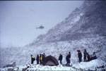
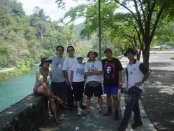
I once participated in an activity organized by a mountaineering federation in its bid to contribute its share in preserving the environment.
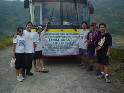
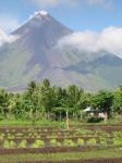
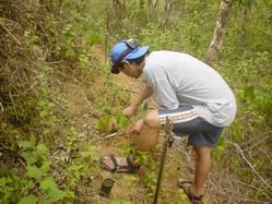
It was a tree-nurturing project for the Angat Watershed. A watershed, as defined by dictionary.com, is a ridge of high land dividing two areas that are drained by different river systems.

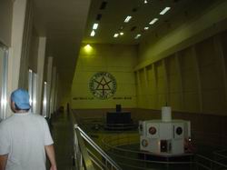
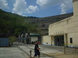
Before conducting the tree-planting activity, everyone was ushered inside the Angat River Hydroelectric Plant operations building for a mini-lecture and tour. Right after everything was done there, we took our lunch.

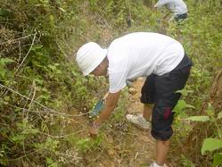
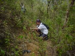
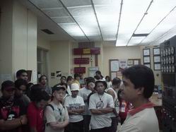
Afterwards, the organizing group made a small lecture on how to handle the seedlings for planting, how to plant them, where to plant them, etc.

This very significant watershed was being (and still is) abused by illegal loggers. They provide a serious threat to this used-to-be-the-best preserved watershed in Asia. During that time, soldier troops were being pulled out from the area and illegal loggers took advantage of the situation. The forest rangers guarding the said area where being ambushed by these timber poachers.
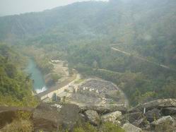

The principal river, Angat River, originates from the western flank of the Sierra Madre Mountains. It then cuts through the mountainous terrain in a westerly direction to the dam site. The elevation within the watershed rises to a maximum of 1,115 meters at the Sierra Madre Mountain range and is lowest at the dam site at 100 meters. It has three major tributaries, namely, the Talaguio, Catmon and Matulid Rivers. The Angat Watershed has a moderate to intensive forest cover and has a drainage area of about 568 square kilometers, which receives an average annual rainfall of about 4,200 millimeters.
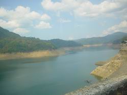
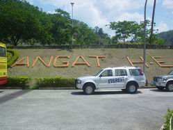
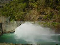
The Angat Reservoir and Dam are located at the Angat River in San Lorenzo, Norzagaray, Bulacan. The facilities were constructed from 1964 to 1967 and have been operational since 1968.
They have multi-purpose functions:
To provide irrigation to about 31,000 hectares of land in 20 municipalities and towns in Pampanga and Bulacan;
To supply the domestic and industrial water requirements of residents in Metro Manila;
To generate hydroelectric power to feed the Luzon Grid; and
To reduce flooding to downstream towns and villages.
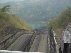
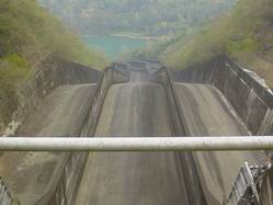
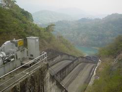
The Angat Dam is a rockfill dam with a spillway equipped with three gates at a spilling level of 219 meters. Its storage capacity is about 850 million cubic meters. Water supply to the MWSS is released through five auxiliary turbines where it is diverted to the two tunnels going to the Ipo Dam.
About 76% of the water supply for Metro Manila comes from the Angat Reservoir, with the rest of the supply coming from the Ipo and La Mesa Watersheds and from groundwater. The Ipo and La Mesa Watersheds contribute about 14 percent and seven percent of the total supply, respectively, while only about three percent comes from groundwater.
(info derived from Manila Water)
I once participated in an activity organized by a mountaineering federation in its bid to contribute its share in preserving the environment.

It was a tree-nurturing project for the Angat Watershed. A watershed, as defined by dictionary.com, is a ridge of high land dividing two areas that are drained by different river systems.

Before conducting the tree-planting activity, everyone was ushered inside the Angat River Hydroelectric Plant operations building for a mini-lecture and tour. Right after everything was done there, we took our lunch.

Afterwards, the organizing group made a small lecture on how to handle the seedlings for planting, how to plant them, where to plant them, etc.
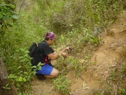


This very significant watershed was being (and still is) abused by illegal loggers. They provide a serious threat to this used-to-be-the-best preserved watershed in Asia. During that time, soldier troops were being pulled out from the area and illegal loggers took advantage of the situation. The forest rangers guarding the said area where being ambushed by these timber poachers.

The principal river, Angat River, originates from the western flank of the Sierra Madre Mountains. It then cuts through the mountainous terrain in a westerly direction to the dam site. The elevation within the watershed rises to a maximum of 1,115 meters at the Sierra Madre Mountain range and is lowest at the dam site at 100 meters. It has three major tributaries, namely, the Talaguio, Catmon and Matulid Rivers. The Angat Watershed has a moderate to intensive forest cover and has a drainage area of about 568 square kilometers, which receives an average annual rainfall of about 4,200 millimeters.


The Angat Reservoir and Dam are located at the Angat River in San Lorenzo, Norzagaray, Bulacan. The facilities were constructed from 1964 to 1967 and have been operational since 1968.
They have multi-purpose functions:


The Angat Dam is a rockfill dam with a spillway equipped with three gates at a spilling level of 219 meters. Its storage capacity is about 850 million cubic meters. Water supply to the MWSS is released through five auxiliary turbines where it is diverted to the two tunnels going to the Ipo Dam.
About 76% of the water supply for Metro Manila comes from the Angat Reservoir, with the rest of the supply coming from the Ipo and La Mesa Watersheds and from groundwater. The Ipo and La Mesa Watersheds contribute about 14 percent and seven percent of the total supply, respectively, while only about three percent comes from groundwater.
(info derived from Manila Water)